


Kennedy catches a drone while mapping archaeological sites in Peru in 2017. Photograph by Rachel Penfil.
Drone Mapping

Excavations
Taking drone photographs after each excavation level allows for a wider view and less background shadow disturbance.

Site Mapping
High aerial photos from the sky facilitates initial site mapping and photos are used later for photogrammetry.
3-D Modeling and Printing
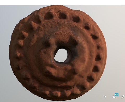
Spindle Whorl
A ceramic spindle whorl recovered from a colonial silver refinery near Puno, Peru. Spindle whorls were fitted to the end of wooden spindles and used to increase the speed of the spindle, when spinning raw wool into yarn.

Stone Scraper
A stone tool used for scraping and chopping found at a colonial silver refinery near Puno, Peru. It was made from red chert material. Even though this artifact is from the 18th century, most tools found at this site were made of stone, with very few metals tools.
To discuss these 3-D models, as well as information on how to print them on 3-D printers, contact me today.
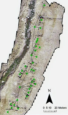
GIS
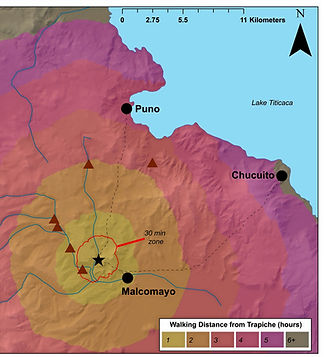
Mapping the Puno Bay
Space Syntax
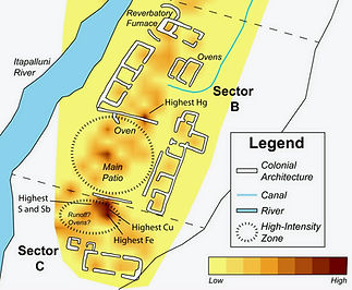
pXRF Heavy Metals
Illustrations
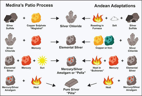
Silver Refining
Artifact Tracing

Feature Tracing

Statistics and Data Management
Statistics
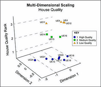
Multi-Dimensional Scaling
I use multi-dimensional scaling in my research to investigate large data sets with various variables. This image shows the similarity between excavation units at the site of Trapiche by house quality.
Data Storage
Pitt Data Repository
My data is stored and available at the University of Pittsburgh's Center for Comparative Archaeology's Data Repository. In Peru, I worked with the Ministry of Culture and the Collasuyo Archaeological Research Institute to store archaeological remains.
Statistics
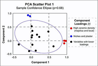
PCA
I use principal components analysis to investigate large data sets in my research. In this figure, I mapped component loadings in a scatter plot to represent that amount of variance explained by 2 components in my data.